The allure of untouched nature often draws individuals to seek out its less-trodden paths. Among the myriad of natural wonders, waterfalls hold a particular fascination. Their chaotic beauty, the raw power of cascading water, and the often secluded locations contribute to their mystique. However, not all waterfalls are advertised on tourist maps. The pursuit of these hidden gems, the art of waterfall hunting, involves a blend of preparation, observation, and a willingness to venture beyond the obvious.
Before setting foot on a trail, thorough research is paramount for any aspiring waterfall hunter. This initial phase is not about seeking out pre-determined destinations but about understanding the potential for discovery. It requires a strategic approach to gathering information.
Understanding Geological Indicators
Waterfalls are not random occurrences. Their formation is deeply rooted in geological processes. Understanding these processes can significantly narrow down potential search areas.
Erosion and Rock Formations
The primary force behind waterfall creation is erosion, particularly the differential erosion of rock strata. Harder, more resistant rock layers overlay softer, less resistant ones. As water flows over these formations, it erodes the softer rock more quickly, creating a step or a drop. Identifying regions with significant geological variation, such as escarpments, cliff faces, and gorges, is a good starting point. Areas with sedimentary rock formations, particularly sandstone and limestone, are often conducive to waterfall development due to their varying degrees of resistance to weathering and erosion.
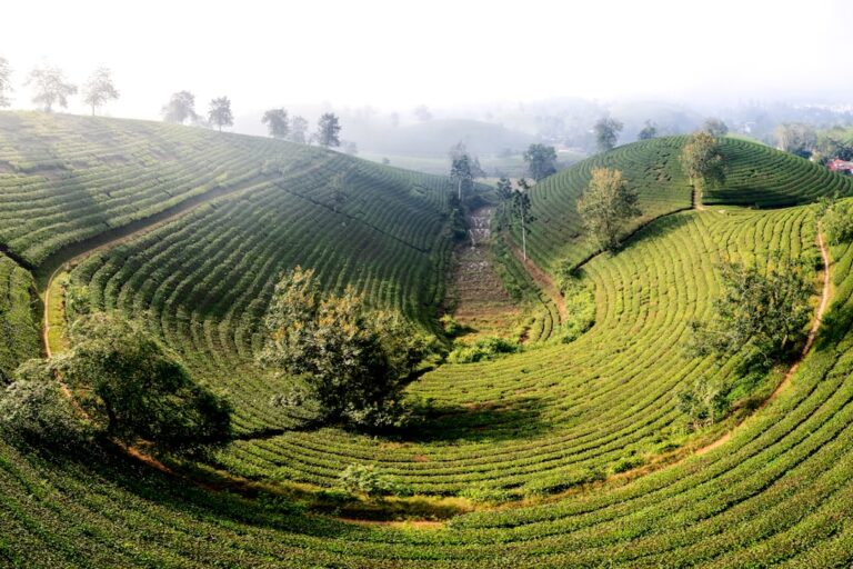
River and Stream Networks
The density and gradient of river and stream networks are crucial. Areas with a high density of perennial streams traversing elevated terrain are more likely to harbor waterfalls. Examining topographic maps, both paper and digital, can reveal steep gradients and the presence of numerous waterbodies, indicating potential drops. Satellite imagery can also offer visual clues, highlighting distinct changes in elevation along watercourses.
Utilizing Existing Data Sources
While the focus is on hidden falls, existing data can provide a foundation. It’s not about finding a list of secret spots, but understanding where waterfalls, in general, are likely to exist.
Historical Topographical Maps and Geological Surveys
Older topographical maps can sometimes depict features that have since been altered, eroded further, or simply overlooked in newer surveys. Geological surveys, often published by governmental agencies, provide detailed information about rock types, fault lines, and landforms that are highly relevant to waterfall formation. These documents can be found in libraries, university archives, and online repositories.
Local Lore and Historical Accounts
Sometimes, local knowledge, passed down through generations or documented in local histories, can offer clues. These might be vague references to “the place where the water falls” or descriptions of specific landmarks. While these accounts may not directly point to a waterfall, they can suggest areas worth further investigation. It’s important to approach such information critically, distinguishing between myth and genuine observation.
Essential Gear and Safety Considerations
Proper preparation extends beyond geographical knowledge to practical considerations for navigating potentially wild terrain.
Navigation Tools and Techniques
Beyond a GPS device, a compass and an understanding of how to use it are indispensable. Topographic maps are vital for understanding terrain and planning routes. Learning to read contour lines and identify potential stream sources is a fundamental skill. Always inform someone of your intended route and expected return time.
Appropriate Footwear and Clothing
Trekking through rough terrain, often wet and uneven, necessitates sturdy, waterproof hiking boots with good ankle support. Quick-drying clothing, layers for temperature regulation, and a waterproof outer shell are essential. Carrying a first-aid kit, a multi-tool, and sufficient water and food are non-negotiable safety measures.
The Hunt: Scouting and Observation
Once the foundational research is complete, the active phase of waterfall hunting begins. This involves detailed observation of the landscape and understanding how water interacts with it.
Interpreting Landscape Features
The ability to “read” the landscape is a skill honed through experience. Certain features on the ground directly suggest the presence or absence of waterfalls.
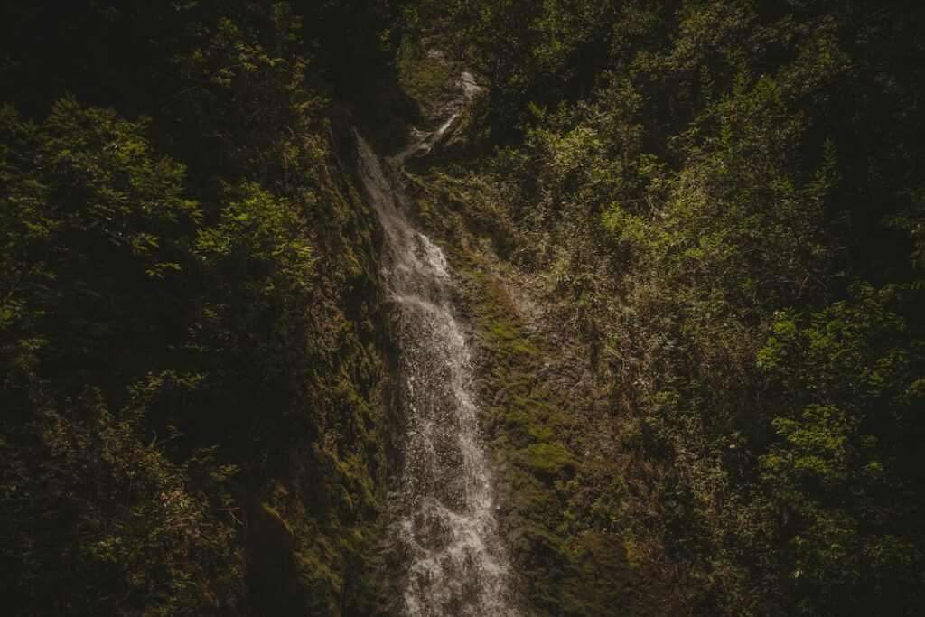
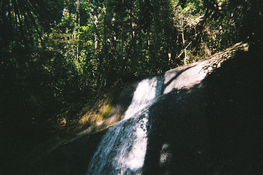
Stream Bed Morphology
The appearance of a stream bed can offer significant clues. A stream that abruptly becomes significantly steeper, with evidence of turbulent water flow and worn rocks, suggests a potential drop. Conversely, a continuously gentle gradient indicates a lack of significant waterfalls. Look for areas where the stream narrows or widens unexpectedly against a change in gradient.
Vegetation as an Indicator
Vegetation patterns can also provide subtle hints. Areas with persistent mist or high humidity, often found around waterfalls, can support distinct plant communities. Conversely, the absence of lush vegetation on a steep slope might indicate dry conditions, suggesting a less reliable water source. The presence of mosses concentrated on rock faces, especially those adjacent to watercourses, can signal areas of consistent moisture.
Following the Watercourse
The most logical approach to finding a waterfall is to follow a watercourse. This is often a time-consuming and challenging endeavor.
Following Streams Uphill
Beginning at a known water source, such as a confluence of streams or a larger river, and following a smaller tributary upstream is a common strategy. This method requires patience and a willingness to navigate obstacles. The gradient of the stream bed is the most direct indicator of potential drops.
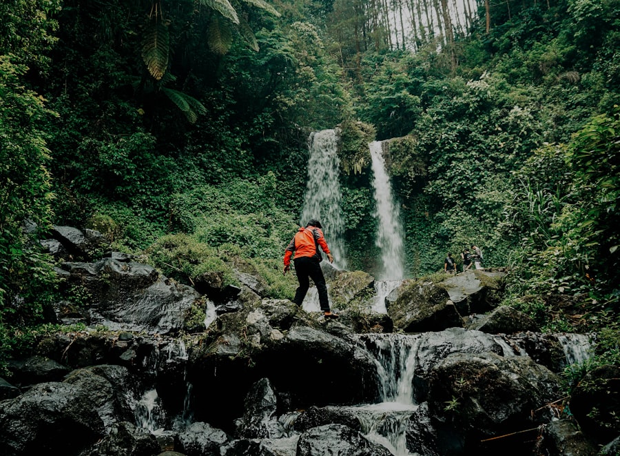
Examining Ravines and Canyons
Ravines and canyons are natural conduits for water and often contain significant vertical drops. Exploring these features requires careful attention to safety due to steep inclines and potential for rockfalls. The presence of sheer rock faces within these formations is a strong indicator of waterfall potential.
The Role of Sound and Scent
Sensory clues can be surprisingly effective in locating hidden waterfalls, particularly in dense vegetation where visual observation is limited.
Listening for the Roar
The sound of falling water, even from a distance, can be a tell-tale sign. The intensity of the sound can often indicate the size and proximity of a waterfall. In areas with dense foliage, the acoustic properties of the terrain can amplify the sound of water.
The Scent of Mist and Damp Earth
The distinctive damp, earthy smell associated with mist and spray is another sensory cue. This scent is often stronger near waterfalls, particularly those that create a considerable amount of aerosolized water.
Beyond the Obvious: Techniques for Deeper Discovery
Finding waterfalls often requires moving beyond the most straightforward methods and employing more nuanced observational skills.
Off-Trail Exploration and Bushwhacking
For truly hidden falls, venturing off established trails is often necessary. This carries a higher risk and demands exceptional preparedness and navigational skills.
Navigating Dense Vegetation
Dense forests and thick undergrowth can obscure the landscape. Techniques for efficient and safe bushwhacking, minimizing impact on the environment, are important. This might involve using a machete or sturdy hiking pole to clear light brush, but always with respect for the natural environment.
Understanding Microclimates
Waterfalls create unique microclimates characterized by higher humidity and cooler temperatures. Observing subtle shifts in temperature and humidity as one travels can indicate proximity to these features.
Utilizing Unconventional Mapping Tools
While standard maps are essential, other tools can provide different perspectives.
Satellite Imagery and Aerial Photography Analysis
Detailed analysis of high-resolution satellite imagery and historical aerial photographs can reveal subtle features. Changes in vegetation patterns, patterns of erosion, or even faint lines on the landscape that might indicate a hidden drop can be observed. Examining multiple sources from different time periods can highlight changes that are indicative of water features.
LiDAR Data Interpretation
Light Detection and Ranging (LiDAR) data can penetrate forest canopy to create highly detailed topographic maps, revealing subtle elevation changes that might be missed on traditional maps. This technology is becoming more accessible and can be a powerful tool for identifying potential locations.
The Patience of Observation
Waterfall hunting is not a race. The most rewarding discoveries often come from patient, sustained observation of the environment.
Spending Time in Promising Areas
Sometimes, the best approach is to spend time in an area deemed promising based on initial research. Sitting still and observing the flow of water, the subtle changes in the landscape, and listening for sounds can reveal features that were not apparent during a hasty passage.
Revisiting Locations at Different Times of Year
The appearance and accessibility of waterfalls can change dramatically with the seasons. A waterfall that is a trickle in a dry season might be a roaring cascade during the wet season. Similarly, snowmelt can create temporary waterfalls. Understanding these seasonal variations can inform scouting efforts.
Documenting and Understanding Your Discoveries
Part of the satisfaction of waterfall hunting lies in documenting and understanding what has been found. This involves more than just taking a photograph.
Photography and Videography Techniques
Capturing the essence of a waterfall requires more than just pointing a camera.
Capturing Scale and Power
Techniques such as using a wide-angle lens to convey the expanse of the fall and its surroundings, or a telephoto lens to isolate specific details, can be employed. Long exposure photography can be used to create a silky smooth effect of the water, emphasizing its movement. Including a person or a recognizable object in the frame can help establish scale.
Environmental Context
It’s important to photograph the waterfall within its surrounding environment. This helps to understand its ecological context and the geological forces that created it. Shots that incorporate the approach to the waterfall, the stream leading to it, and the flora and fauna of the area add depth to the documentation.
Notes and Field Journals
Detailed notes are crucial for recalling specific locations and understanding the context of a discovery.
Recording Location Data
Precise GPS coordinates are essential, but also noting landmarks, rock types, vegetation, and approximate distance from known features can be invaluable for future reference or for sharing (with caution).
Environmental Observations
Recording details about water flow, water temperature, the sound intensity, the presence of mist, and surrounding geological formations can contribute to a deeper understanding of the waterfall and its environment. Note any unique characteristics of the rock face or the pool at the base.
Ethical Considerations and Responsible Exploration
The pursuit of hidden natural wonders comes with a responsibility to preserve them.
Leave No Trace Principles
Adhering to Leave No Trace principles is paramount. This means packing out everything brought in, staying on durable surfaces when possible, minimizing campfire impacts, respecting wildlife, and being considerate of other visitors.
Minimizing Impact on Fragile Ecosystems
Waterfalls and their surrounding environments often host delicate ecosystems. Avoiding trampling vegetation, not disturbing wildlife, and refraining from carving or altering rock formations are essential to preserving these areas.
The Continuing Quest: Embracing the Unknown
| Waterfall Name | Location | Height | Difficulty |
|---|---|---|---|
| Hidden Falls | Grand Teton National Park, Wyoming | 100 feet | Moderate |
| Rainbow Falls | Great Smoky Mountains National Park, Tennessee | 80 feet | Easy |
| Lower Falls | Yellowstone National Park, Wyoming | 308 feet | Difficult |
The art of waterfall hunting is not a finite pursuit with a definitive end. It is a continuous journey of exploration and discovery.
Creating Your Own Map of Mysteries
Instead of relying solely on existing information, the process of waterfall hunting can lead to the creation of personal maps, filled with annotated locations and potential future explorations. These maps become a testament to one’s own engagement with the natural world.
The Value of Serendipity
While preparation is key, the most exciting discoveries are often serendipitous – a chance encounter with a feature that was not anticipated. Embracing these moments of unexpected beauty is a crucial part of the experience.
Sharing Knowledge Responsibly
The decision to share information about discovered waterfalls is a personal one. If choosing to share, doing so responsibly by providing only general locations or encouraging others to undertake their own investigations is often preferred over revealing precise coordinates to sensitive or environmentally fragile locations. The aim is to inspire a similar spirit of adventure and respect for nature, not to create traffic for vulnerable sites.
Discovering hidden waterfalls is more than a hobby; it is an engagement with the geological history and the dynamic forces that shape our planet. It requires a blend of scientific understanding, keen observation, and a respectful approach to the natural world. The satisfaction comes not just from the destination, but from the journey of seeking, observing, and appreciating the less-obvious marvels that nature offers to those willing to look for them.
FAQs
What is waterfall hunting?
Waterfall hunting is the activity of seeking out and discovering hidden or lesser-known waterfalls in various locations. It often involves hiking, exploring off-the-beaten-path areas, and enjoying the natural beauty of these hidden falls.
What are the best ways to discover hidden waterfalls?
The best ways to discover hidden waterfalls include researching online resources, such as travel blogs and websites dedicated to waterfall hunting. Additionally, joining local hiking or outdoor enthusiast groups can provide valuable insights and tips for finding hidden falls. Exploring national parks, nature reserves, and wilderness areas can also lead to the discovery of hidden waterfalls.
What should I consider before going waterfall hunting?
Before going waterfall hunting, it’s important to consider factors such as the difficulty level of the hike, weather conditions, and the need for proper gear and supplies. It’s also essential to respect the environment and follow Leave No Trace principles to preserve the natural beauty of the waterfalls and their surroundings.
Are there any safety precautions to keep in mind while waterfall hunting?
When waterfall hunting, it’s crucial to prioritize safety by staying on designated trails, wearing appropriate footwear, and being mindful of slippery or uneven terrain near waterfalls. It’s also important to be aware of potential wildlife encounters and to carry essential safety items such as a first aid kit and sufficient water.
What are some popular destinations for waterfall hunting?
Popular destinations for waterfall hunting include regions with diverse landscapes and abundant natural beauty, such as the Pacific Northwest, the Appalachian Mountains, and various national parks across the United States. Internationally, countries like Iceland, New Zealand, and Japan are known for their stunning waterfalls and offer ample opportunities for waterfall hunting.